Geospatial Intelligence Platform

GlobeZoom

360° land parcel intelligence with satellite imagery, multi-spectral analytics, crop monitoring, flood forecasting, and field survey management — all on a single platform.

500M+
Parcels Mapped
Pan-India
Coverage
Explore expand_more
Parcel Intelligence

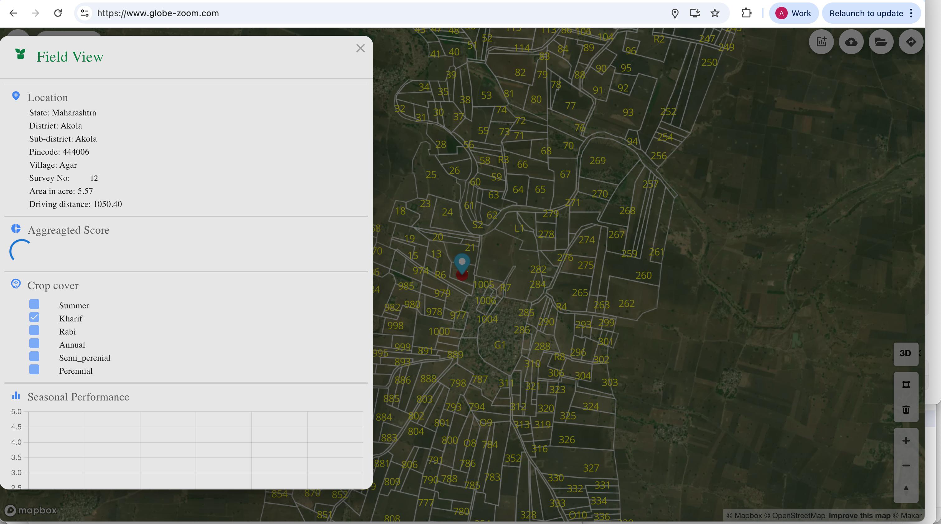
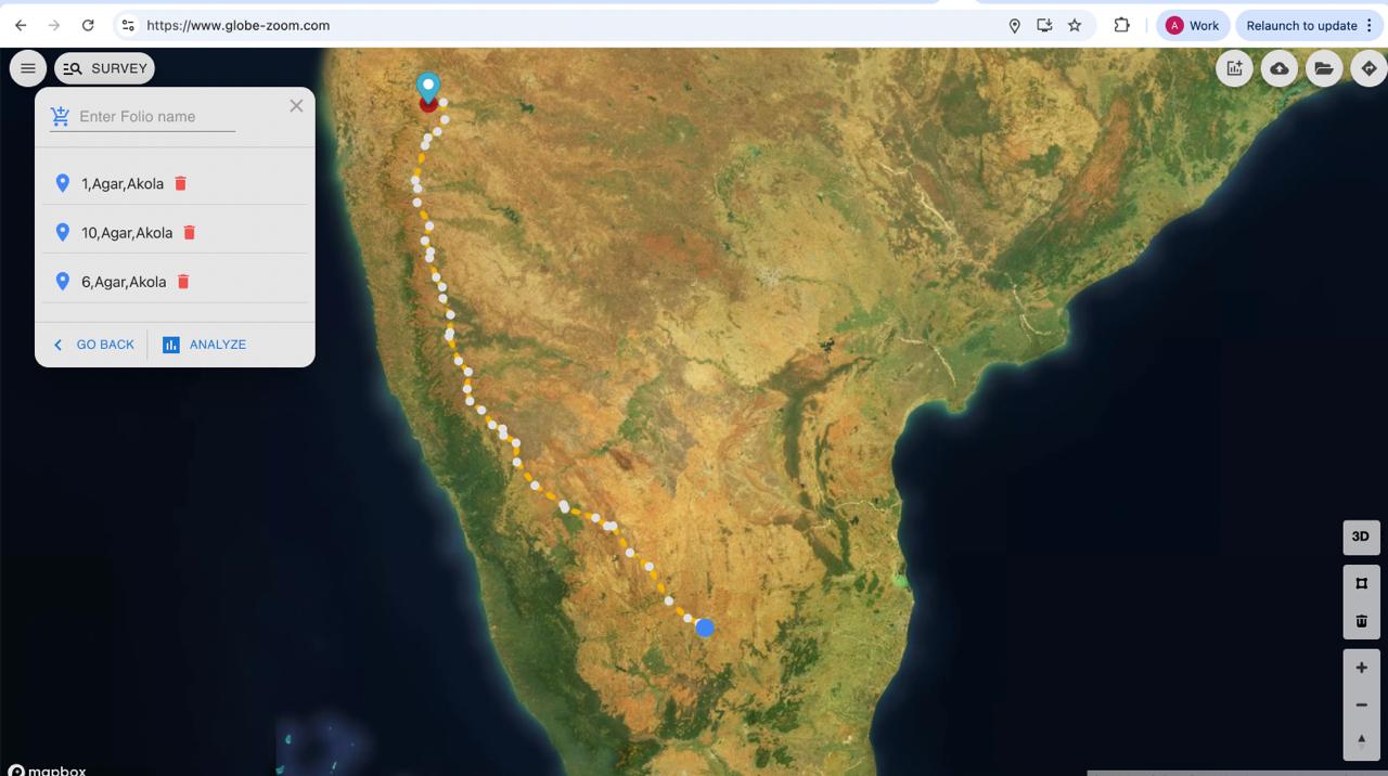
Geo-Referenced Field View

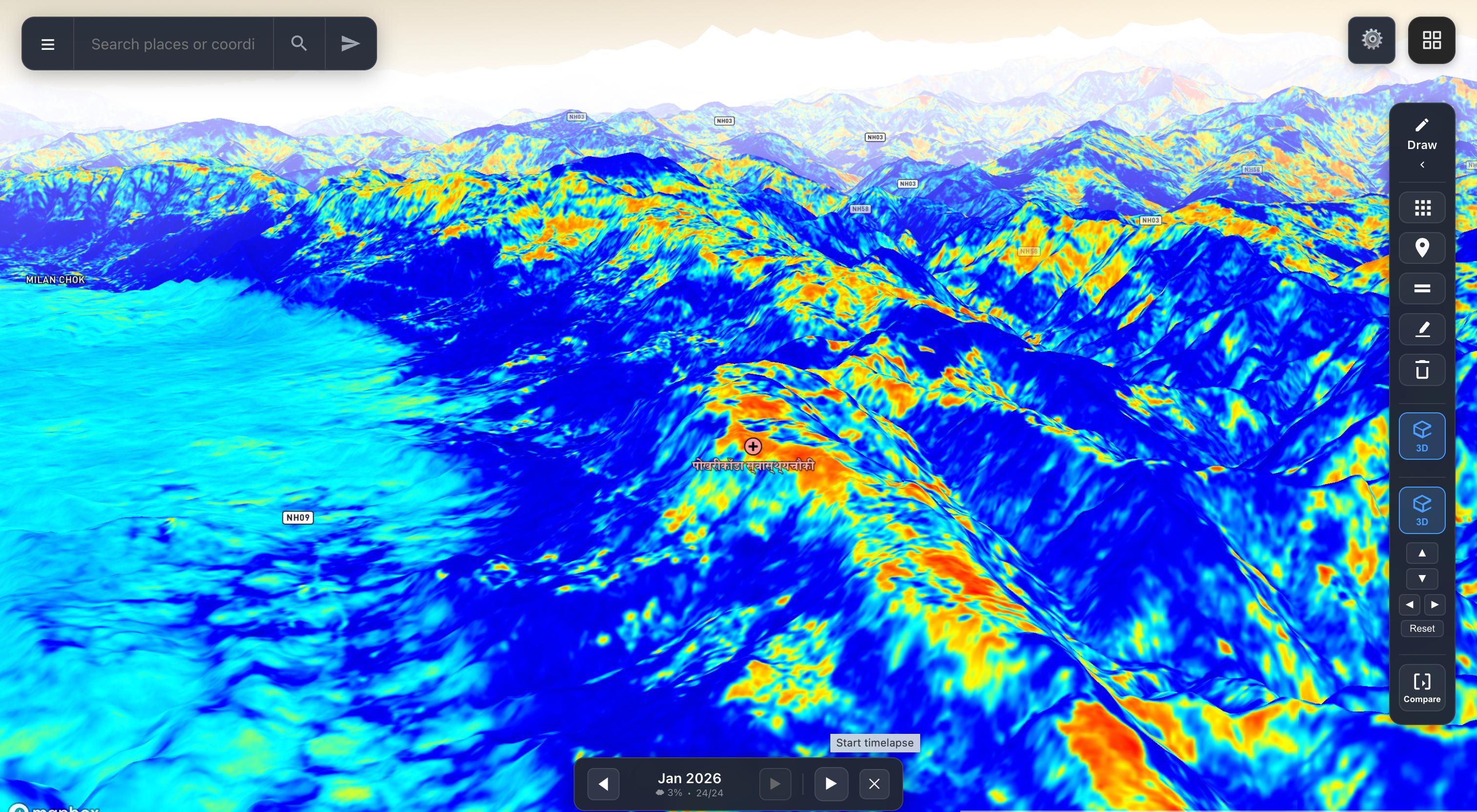
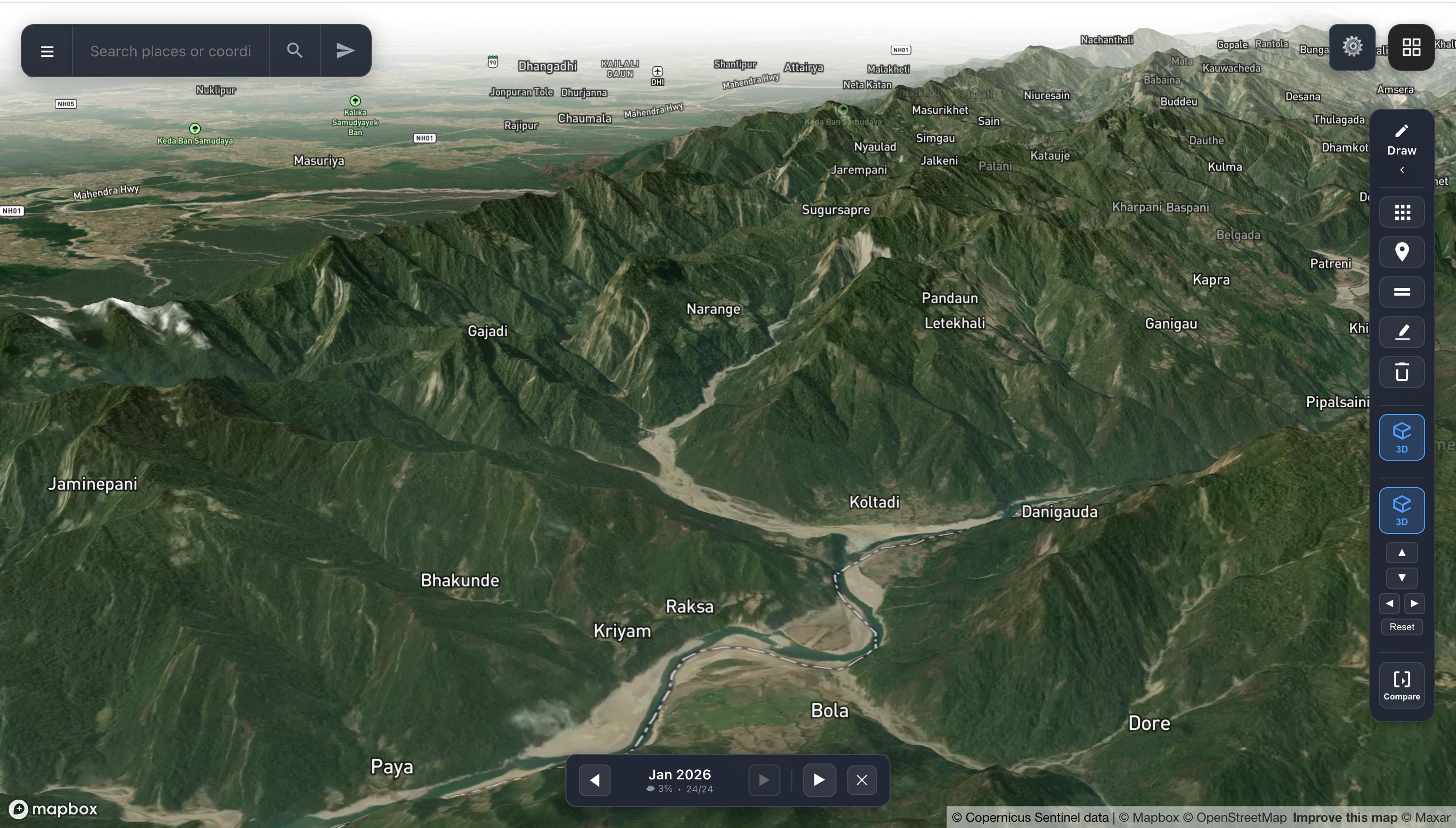
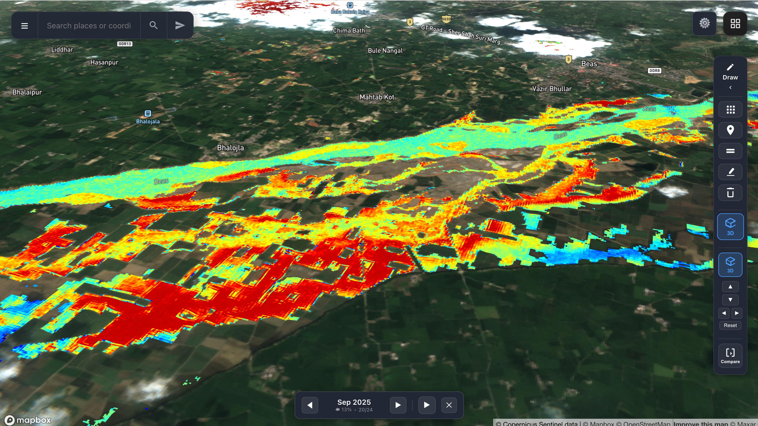
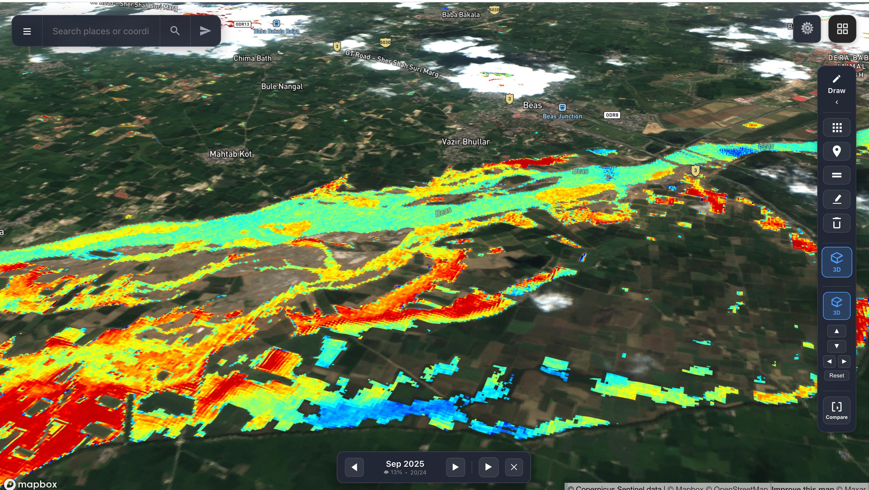
Every land parcel mapped with precise geo-coordinates. Click any parcel to see location details, survey numbers, area measurements, aggregated performance scores, crop cover history, and seasonal performance — all without a field visit.

  • location_on State, district, sub-district, village, pincode, survey number
  • straighten Area in acres with driving distance from nearest branch
  • trending_up Aggregated score for quick parcel assessment
  • grass Crop cover breakdown: Kharif, Rabi, Summer, Annual, Perennial
  • bar_chart Multi-season performance rating on a 5-point scale
GlobeZoom Field View — parcel details with location, crop cover, and seasonal performance
Satellite Analytics

Multi-Spectral Imagery

Switch between hundreds of proprietary and standard spectral indices to analyze vegetation health, moisture levels, land use patterns, fire risk, and crop classification. Each layer tells a different story — from crop stress to irrigation adequacy to real-time hazard detection.

  • satellite_alt Vegetation health indices — NDVI, SAVI, EVI, and proprietary composites
  • local_fire_department Real-time fire detection and active burn area monitoring
  • grass Crop mapping — automated crop type classification across seasons
  • water_drop Moisture and water stress indices for irrigation assessment
  • layers 100s of custom indices — built for specific use cases and continuously expanding
GlobeZoom NDVI satellite layer showing vegetation health across Akola region
Vegetation Monitoring

PlanetSync Vegetation Layer

A proprietary enhanced vegetation layer that provides clearer, more granular insights than standard NDVI. Identifies active cultivation zones, fallow land, and crop density across thousands of hectares in a single view.

  • eco Distinguish active cropland from fallow and barren zones
  • timeline Temporal filters to compare across crop seasons
  • compare Side-by-side comparison with true color imagery
  • zoom_in Zoom from district-level down to individual parcels
GlobeZoom PlanetSync vegetation layer showing crop coverage in green
Field Operations

Intelligent Survey Routing

Plan field surveys with optimized route planning. The platform calculates distances, estimated travel times, and provides turn-by-turn navigation to remote parcels — reducing survey costs and improving operational efficiency.

  • route Distance calculation with turn-by-turn route guidance
  • timer Estimated duration for field agent planning
  • pin_drop Precise destination coordinates with lat/long
  • savings Reduce field visit costs by 60% with pre-screening
GlobeZoom survey route planning showing distance calculation across India map
Portfolio Management

Folio-Based Survey Management

Organize parcels into folios for structured portfolio management. Assign multiple parcels to a survey route, track field agent progress, and analyze results — ideal for banks managing agricultural loan portfolios.

  • folder_managed Group parcels into named folios for batch processing
  • analytics One-click analysis of entire folio portfolios
  • person_pin Track field agent assignments and survey status
  • verified Automated compliance checks against lending criteria
GlobeZoom folio management showing survey parcels in Agar, Akola
Earth Observation

3D Terrain & Thermal Mapping

Immersive 3D terrain visualization with thermal overlays. Analyze topography, elevation changes, and surface temperature patterns — critical for flood risk assessment, watershed management, and infrastructure planning.

  • terrain High-resolution 3D terrain model with real elevation data
  • thermostat Thermal heatmap overlay for surface temperature analysis
  • draw Drawing tools for marking regions of interest
  • timeline Historical timeline playback for change detection
GlobeZoom 3D terrain view with thermal heatmap overlay in mountainous region
Terrain Intelligence

High-Fidelity 3D Earth View

Navigate the earth in stunning 3D with Sentinel satellite data overlaid on real terrain. Inspect river basins, mountain ranges, and agricultural valleys with Copernicus Sentinel data at configurable spatial resolution.

  • public Copernicus Sentinel data integration with configurable resolution
  • water River basin and watershed delineation
  • landscape Mountain and valley topography analysis
  • compare Compare tool for before/after disaster assessment
GlobeZoom 3D terrain view of mountain valleys and rivers with Sentinel data
FloodCast Module

Flood Forecasting & Delineation

Real-time and historical flood extent mapping using satellite SAR data. Color-coded severity visualization shows flood progression over time — enabling early warnings, damage assessment, and post-disaster recovery planning.

  • flood SAR-based flood extent delineation with severity grading
  • palette Color-coded risk: cyan (low) → yellow (moderate) → red (severe)
  • history Historical flood archive for trend analysis
  • notifications_active Early warning alerts for monitored regions
GlobeZoom FloodCast showing flood delineation with severity color coding
Impact Assessment

Flood Impact & Recovery Analysis

Detailed flood impact visualization overlaid on satellite imagery. Assess damage to agricultural land, settlements, and infrastructure. Track water recession and recovery patterns across affected areas.

  • assessment Damage area quantification in hectares and sq. km
  • agriculture Crop loss estimation for affected parcels
  • home_work Settlement and infrastructure impact mapping
  • update Recovery tracking with temporal comparison
GlobeZoom flood impact analysis showing affected areas near Beas river

Integrated Modules

Specialized capabilities built into the GlobeZoom platform

AgriWatch

Crop Intelligence

Geo-referenced land parcel maps with crop identification, irrigation scores, weather watch, risk assessment, and case management for agricultural lending.

AgriCast

Crop Forecasting

AI-powered crop yield forecasting, stress detection using multi-spectral indices, and near real-time monitoring for proactive agricultural decision-making.

FloodCast

Flood Intelligence

SAR satellite-based flood forecasting and delineation with severity mapping, historical analysis, and early warning systems for disaster management.

AgroAtlas

Land Parcel Intelligence

360° land parcel intelligence platform enabling real-time verification without field visits, historical crop performance analysis, and reduced fraud through satellite evidence.

Solutions for Banking & Insurance

AgriWatch powers lending, insurance, and risk management decisions with satellite-verified intelligence — eliminating costly field visits and enabling real-time portfolio monitoring.

star

Plot Performance Ratings

Historical performance ratings across 6+ years — Super Prime, Prime, Average, SubPrime, Poor — with transition probability analysis showing likely performance trajectory over time.

water_drop

Irrigation Score

Per-parcel irrigation scoring based on soil moisture index, crop water requirements, water availability at source, and weather risk assessment — critical for drought exposure analysis.

warning

Stress Watch

Near real-time (daily) crop stress detection across the entire portfolio. Drill down to individual parcels under stress, link stress to specific farmers, and enable targeted relief intervention.

account_balance

Quality Loan Origination

Satellite-verified crop and land data for lending decisions — reduced fraud through independent verification, identification of willful defaulters, and improved collection efficiency.

map

Geo-Referenced Portfolio

Multidimensional cluster maps analyzing portfolio concentration vs. performing clusters. Smart allocation guidance with exposure tracking across geographies and crop types.

shield

Risk & Weather Watch

Continuous weather condition monitoring with impact assessment on standing crops. Predict failures before events occur, monitor intervention effectiveness, and trigger proactive alerts.

Why GlobeZoom

Key Advantages

  • speed Quick turnaround — parcel intelligence in minutes, not days
  • savings Reduced field visit costs with satellite-verified assessments
  • verified Improved loan origination accuracy with satellite evidence
  • security Reduced fraud through independent verification and historical cross-referencing
  • cloud Near real-time monitoring without physical presence
  • history 6+ years of historical performance data across multiple crop cycles
  • target Proactive target marketing and early defaulter identification
  • groups 360° view on all land parcels — performance, irrigation, risk in one place

Experience GlobeZoom

See how satellite intelligence transforms land assessment and agricultural monitoring.

calendar_today Schedule a Demo arrow_back Back to Home apps All Products